Data model & concepts (in progress)
Note
This section still in progress. See ohmg.dev for more information about the structure of the database.
Note
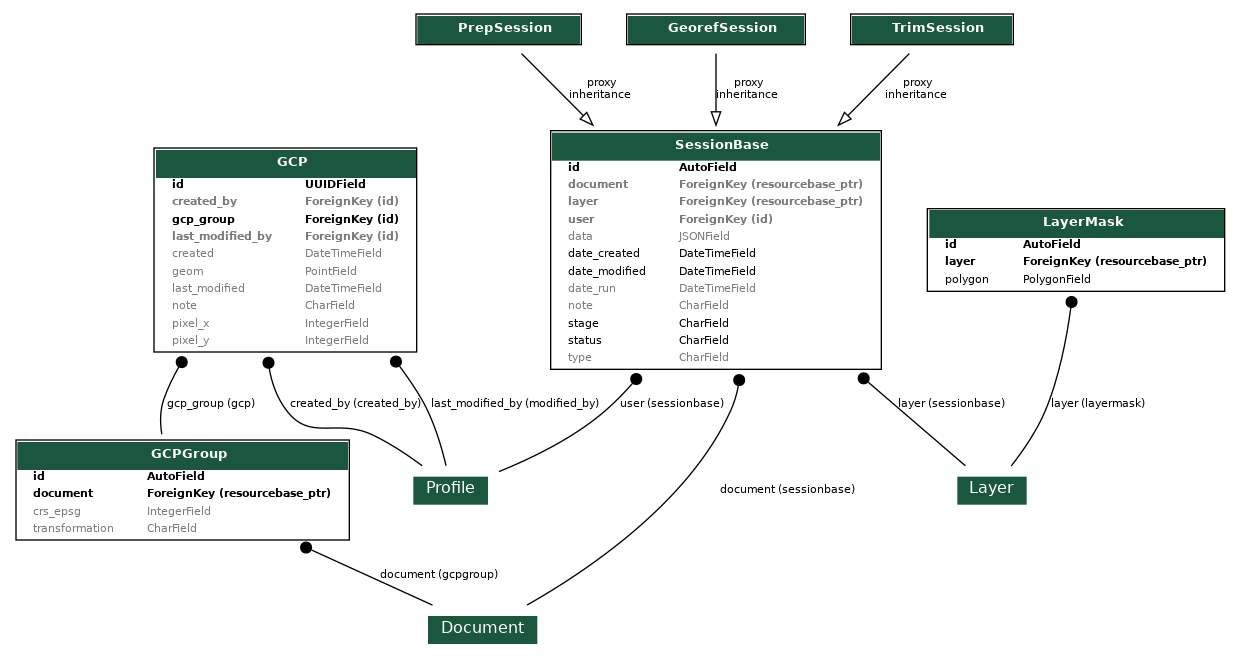
This section mentions TrimSession, which is a model that was deprecated a long time ago when multimask was introduced, but should be reintroduced eventually.
All georeferencing activity is stored in SessionBase objects, as implemented through the proxy models PrepSession, GeorefSession, and TrimSession. Each proxy model has its own implementation of a run() method which uses the information in the data field to perform the appropriate actions.
Narrative Explanation
When a user begins preparing a Document, a new PrepSession is created. If the user creates cutlines to split the document, this information is saved in the session's data field as JSON and then used to run the splitting action that creates new child documents (the original document is not altered).
When a user begins georeferencing a Document, a new GeorefSession is created. When the ground control points have been created and submitted through the interface, they are stored as GeoJSON in the session's data field and then used to warp the Document and create a Layer. Finally, they are saved separately as GCP objects and aggregated into 1 GCPGroup per Document. This facilitates iterative editing of the Document's "canonical" GCPs, while also allowing for the reversion to a past set of GCPs if necessary.
Similarly, a user creates a TrimSession when they begin trimming a Layer. The mask polygon is stored in the session's data and then pushed to the Layer's canonical LayerMask object, and applied as a cropped style in Geoserver.